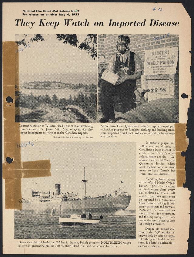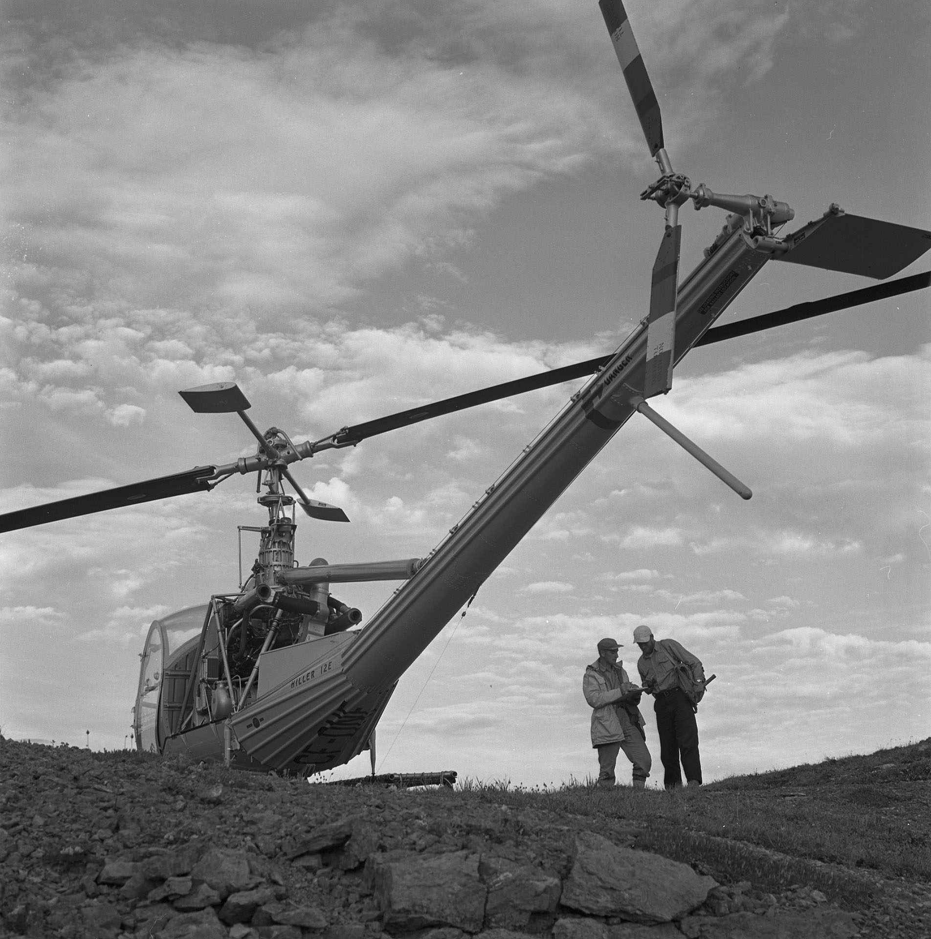
Caption
Helicopter leaves geologists atop Yukon mountain. After traversing ridges by foot they will rendezvous with helicopter for evening pick up.
Date
January 1, 1962
Accession Number
NFB63-2858
Materials
Black and white negative
Photographer
Collection
CMCP collection
Credit Line
© National Gallery of Canada, Ottawa
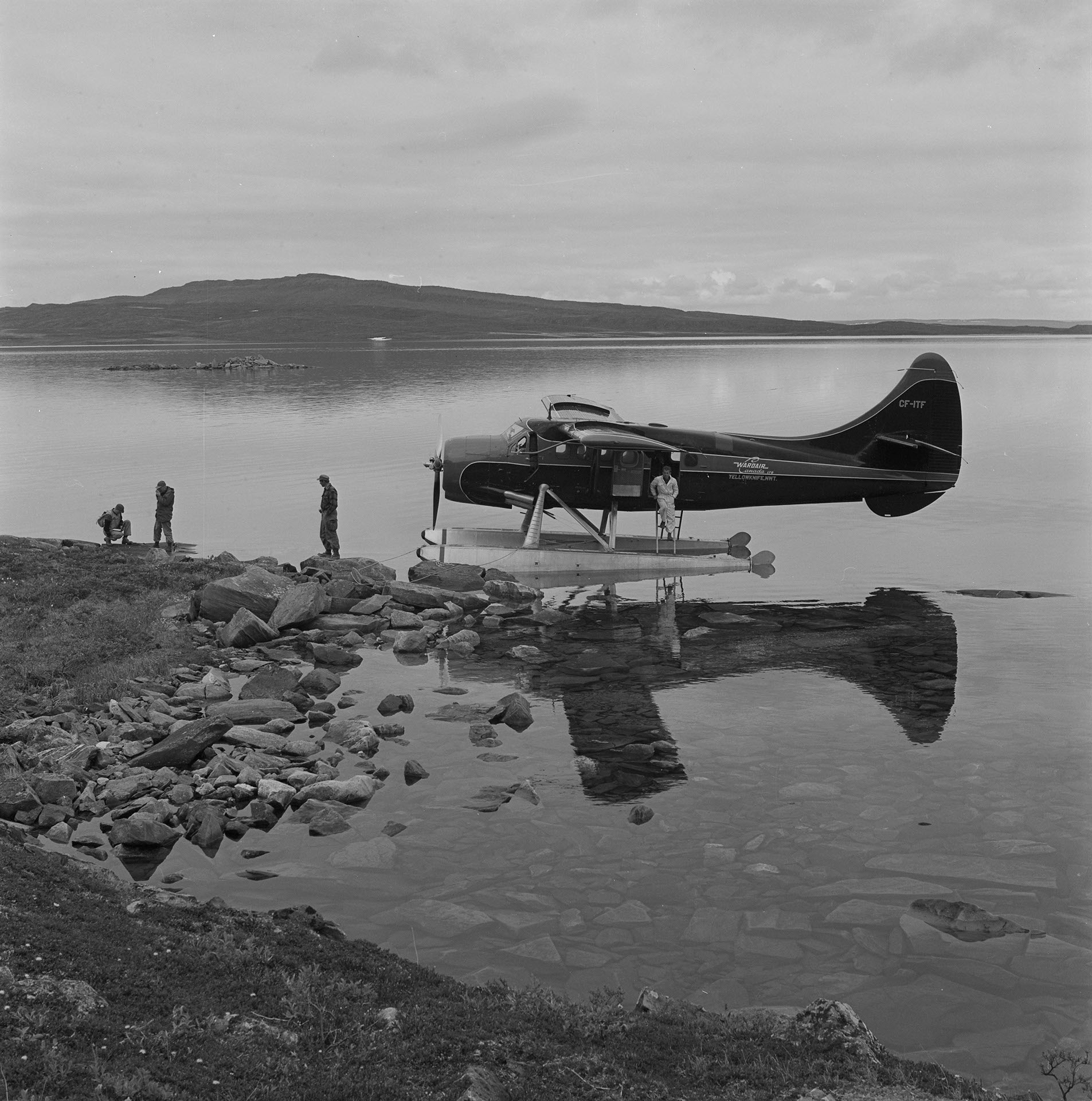
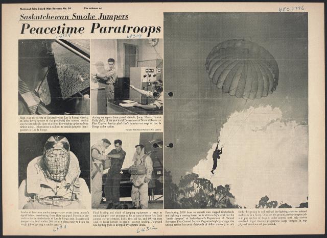
Caption
Otter float-plane lands geological party on lake shore in Bathurst Inlet area of Northwest Territories. Strong indications of oil deposits are now being tested by drilling operations.
Date
January 1, 1962
Accession Number
NFB63-2834
Materials
Black and white negative
Photographer
Collection
CMCP collection
Credit Line
© National Gallery of Canada, Ottawa

Caption
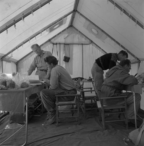
Back in camp reports are made by geologists. From left, Drs. Al Fraser, Weston Blake, Hewart Bostock and William Poole in Bathurst Inlet area, N.W.T.
Date
January 1, 1962
Accession Number
NFB63-2829
Materials
Black and white negative
Photographer
Collection
CMCP collection
Credit Line
© National Gallery of Canada, Ottawa

Caption
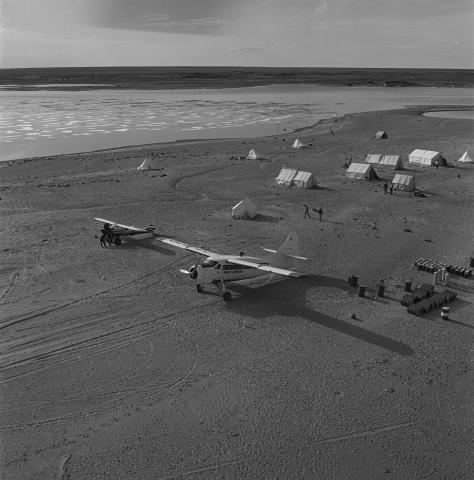
Summer survey camp established on sandbar near Spence Bay, Boothia Peninsula, N.W.T. This party was equipped with a helicopter, Otter and Super Piper Cub.
Date
January 1, 1962
Accession Number
NFB63-2805
Materials
Black and white negative
Photographer
Collection
CMCP collection
Credit Line
© National Gallery of Canada, Ottawa
Caption
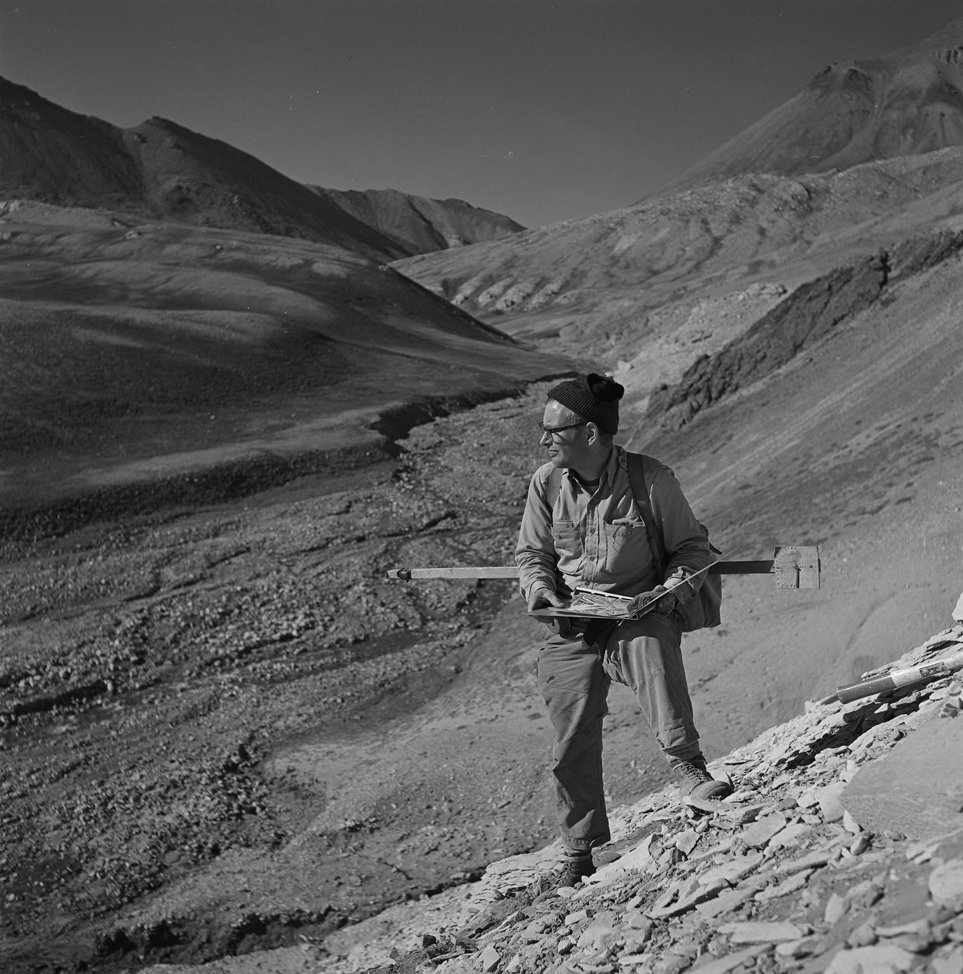
Dr. E. T. Tozer recording rock formations on Ellesmere Island, has decade of arctic geological survey experience.
Date
January 1, 1962
Accession Number
NFB63-2797
Materials
Black and white negative
Photographer
Collection
CMCP collection
Credit Line
© National Gallery of Canada, Ottawa


Photostory #351: Flying Footsloggers Range Far and Wide: Canada's Geological Airborne Campaign
Photographers
Maker
National Film Board of Canada
Release Date
November 19, 1963
Collection
CMCP fonds
Credit Line
Canadian Museum of Contemporary Photography fonds, National Gallery of Canada Library and Archives
Main Text
Just over a decade ago Canada's top geologists sat down to review progress over the past 110 years. They found, despite rugged efforts by generations of tough, hard-bitten predecessors (the Geological Survey of Canada has operated since 1842) more than two-thirds of Canada's sprawling 4,000,000 sq. miles were still unmapped geologically. For a nation so dependent on mineral wealth it was a vital situation. At this rate, another century and a half was needed to finish even a preliminary survey of the country. It was then the helicopter came clattering with whirling blades into the geological picture, to provide a far-seeing observation platform. Combined in operations with fixed-wing airplanes, the helicopter became a magic carpet from which the skilled scientific eyes of experienced geologists could range over mountains and valleys, lakes and barrens. Today, the Geological Survey of Canada launches nearly a dozen simultaneous airborne operations a year. Helicopters, float-planes and balloon-tired aircraft carry geologists on scientific surveys that would have taken scores of years by previous pack-horse, canoe and dog-sled methods. Yet, though this airborne assault is expected to complete the reconnaissance mapping of Canada by 1970, there is still lots of old-fashioned foot-slogging to be done. In fact, during a single field season, some airborne party members may walk more than 500 miles and climb enough mountainsides to total five times the height of Mount Everest.
Subjects:
Locations: