Caption
[no caption]
Date
October 1, 1966
Accession Number
NFB66-13120
Materials
Black and white negative
Photographer
Collection
CMCP collection
Credit Line
© National Gallery of Canada, Ottawa
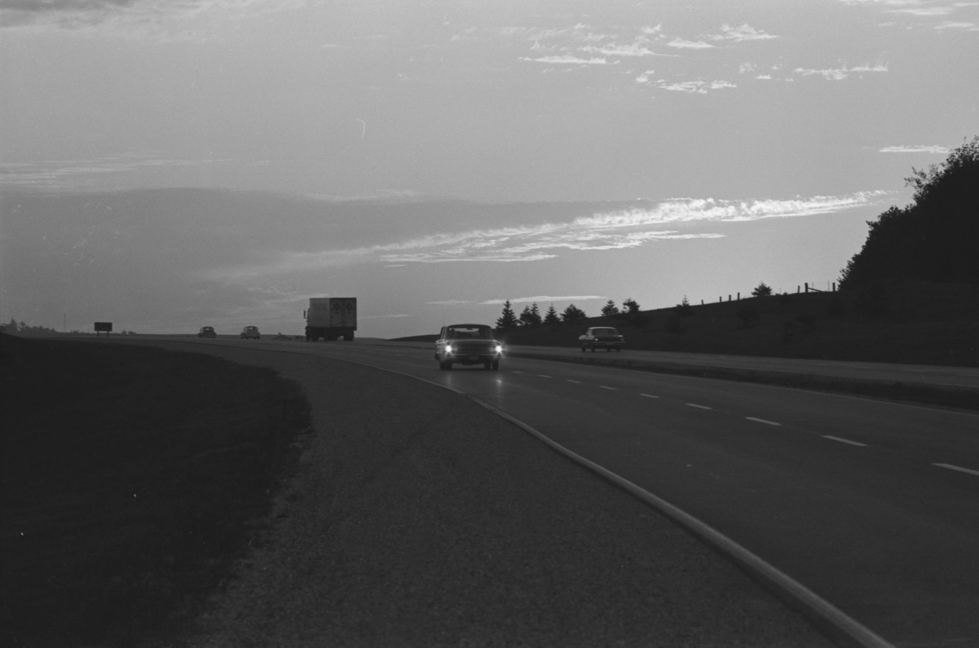
Caption
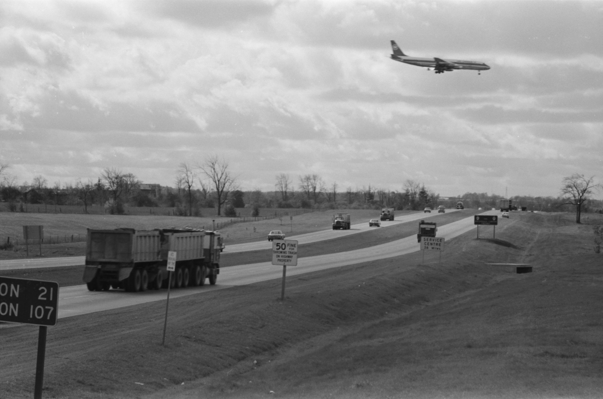
View to the west as heavy traffic roars along the Macdonald-Cartier Freeway near Toronto's international airport.
Date
October 1, 1966
Accession Number
NFB66-13103
Materials
Black and white negative
Photographer
Collection
CMCP collection
Credit Line
© National Gallery of Canada, Ottawa
Caption
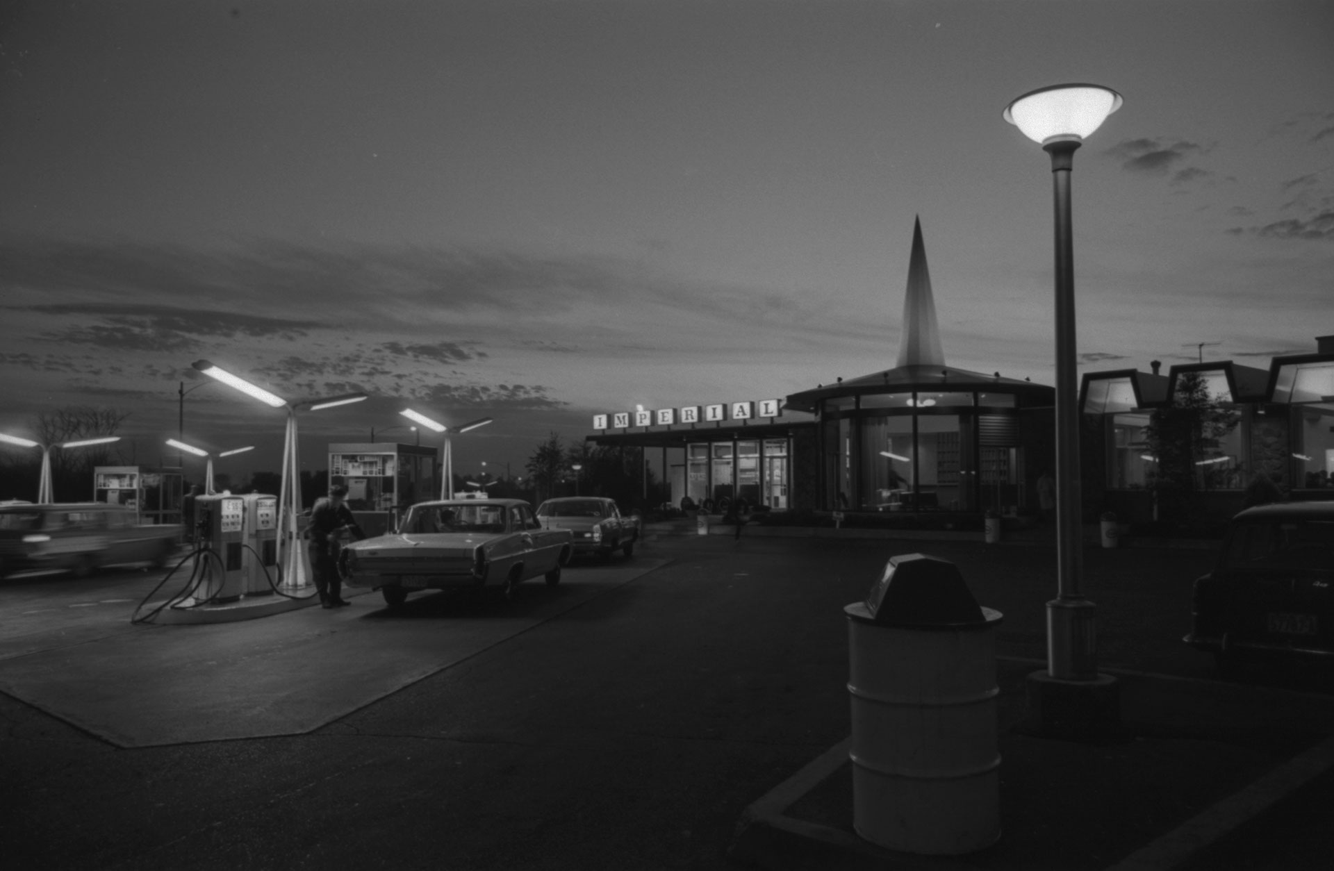
Service center on Ontario's Highway 401, near Oshawa, is one of many which provides either rapid refueling or leisurely meals and a chance to rest from high-speed travel.
Date
October 1, 1966
Accession Number
NFB66-13111
Materials
Black and white negative
Photographer
Collection
CMCP collection
Credit Line
© National Gallery of Canada, Ottawa

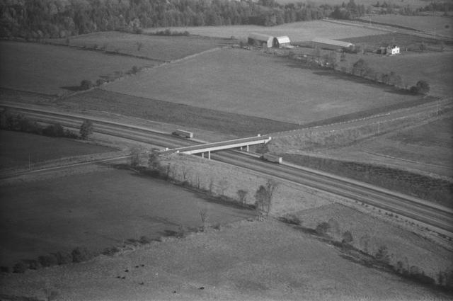
Caption
Aerial view of 401 shows transport trucks carrying heavy loads of merchandise along the Lake Ontario shore region.
Date
October 1, 1966
Accession Number
NFB66-13047
Materials
Black and white negative
Photographer
Collection
CMCP collection
Credit Line
© National Gallery of Canada, Ottawa
Caption
[no caption]
Date
October 1, 1966
Accession Number
NFB66-13085
Materials
Black and white negative
Photographer
Collection
CMCP collection
Credit Line
© National Gallery of Canada, Ottawa
Caption
[no caption]
Date
October 1, 1966
Accession Number
NFB66-13117
Materials
Black and white negative
Photographer
Collection
CMCP collection
Credit Line
© National Gallery of Canada, Ottawa
Caption
Horizon-reaching, toll-free highway near London, symbolizes the speedy route into the future being taken by the southern areas of Ontario and Quebec.
Date
October 1, 1966
Accession Number
NFB66-13079
Materials
Black and white negative
Photographer
Collection
CMCP collection
Credit Line
© National Gallery of Canada, Ottawa


Photostory #434: Ontario-Quebec's Concrete Link for the Future: Canadian Freeway Paved With Progress
Photographers
Maker
National Film Board of Canada
Release Date
January 17, 1967
Collection
CMCP fonds
Credit Line
Canadian Museum of Contemporary Photography fonds, National Gallery of Canada Library and Archives
Main Text
Solid evidence supporting prophesies by leading geographers that future developments in southern Ontario and Quebec will create an industrial super-giant among giants is Canada's Macdonald-Cartier Freeway - Highway 401. Capable of speeding heavy volumes of traffic from Windsor and Detroit through the northern sprawl of the mighty Toronto megapolis to within sight of Montreal's glistening skyline, this 510-mile highway is about to link up with its counterpart in Quebec and sweep on for another 235 wheel-humming miles. This unique transportation artery, cutting across the rich heartland of Ontario and Quebec and following the St. Lawrence Seaway and River is based on a firm bedrock of geographical facts. A 25-mile band either side of its full length from Quebec City to the western end of Lake Erie contains less than one per cent of Canada's nearly 4[??],000 square miles. Yet, this one per cent of the nation contains nearly two thirds of its population, 40 per cent of its commercial agriculture and 85 per cent of its industrial activity. Such facts created the necessity for the highway and the highway in turn is now creating even greater growth along its length. With the new Macdonald-Cartier Freeway this part of Canada will develop at an even more amazing rate of acceleration.
Subjects: